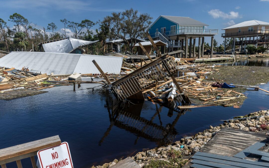
Hurricane Milton is still on course to make a potentially catastrophic landfall near Tampa Bay, despite losing some of its record-breaking intensity from Monday night.
The worst-case scenario for Tampa would be a track that hits the city directly or just to the north. Inundation of more than nine feet above ground level might occur in the area and south to Sarasota due to an unusual 10- to 15-foot surge.
Along and to the north of its route, the storm is expected to deliver a variety of risks, from torrential rainfall to the potentially fatal storm surge. Rainfall might range from 5 to 12 inches, with up to 18 inches possible in certain places.
Significant inland flooding is also predicted to result from this.
READ MORE: Following The Destruction Caused By Hurricane Helene, Two More Storms Strengthen In The Atlantic
NHC also predicts that when Hurricane Milton exits to the Atlantic on Thursday, it could deliver hurricane-force wind gusts well inland, possibly across the peninsula to the east coast.
Hurricane Milton was a high-end Category 4 hurricane with maximum sustained winds of 155 mph as of Tuesday afternoon. It was more intense than it had been on Tuesday morning.

It was located roughly 520 miles southwest of Tampa and was traveling at an 8 mph east-northeast direction.
Strong winds are predicted to start to affect Florida’s west coast during the day on Wednesday and make landfall somewhere on Wednesday evening or early Thursday.
At landfall, Hurricane Milton is predicted to be a powerful Category 3 hurricane.
Forecasters anticipate its wind field to almost double in size before impact, the NHC said Tuesday morning.
READ MORE: Over $1 Million Is Raised By Donald Trump’s GoFundMe For Hurricane Helene Victims
In addition to potentially expanding the area impacted by surge-related damage, this will raise the storm surge’s magnitude.
Along with ensuring that places as far away as Jacksonville and Miami experience its powerful winds, it will also expand the area that can be impacted by prolonged power outages.

Between the lines: Depending on the storm’s precise intensity and path at landfall, simulations of a hurricane comparable to Milton have predicted catastrophic losses in terms of both life and property in Tampa Bay.
A number of causes, including human-caused climate change, worked together to fuel Hurricane Milton’s infrequent “explosive” intensification.
This storm may be more catastrophic now than it would have been even a few decades ago due to sea level rise linked to climate change.
Rapid intensification events are becoming increasingly frequent as a result of global warming. As recently as two weeks ago, the pattern was observed as Hurricane Helene quickly escalated before striking the sparserly populated Big Bend region of Florida.
READ MORE: Dodger Stadium Is Burned In Water By Hurricane Hilary
The storm rapidly escalated over record-warm waters for this time of year.
Compared to a preindustrial world with fewer greenhouse gases in the atmosphere, the likelihood of those ocean temperatures today is up to 800 times higher due to climate change.
based on estimates from the nonprofit research organization Climate Central.
Additionally, atmospheric background factors worked together to accelerate the storm’s maximum sustained winds from 90 mph to 180 mph in less than a day.

The NHC said Tuesday morning that “there is high confidence that Milton will remain an extremely dangerous hurricane when it reaches the state.”
It is important to stress that this is a very severe issue and that citizens of Florida should pay close attention to what their local disaster management professionals are telling them. For west-central Florida, Milton could rank among the most devastating storms ever recorded, according to NHC.
Additionally, the NHC highlighted the normal forecast inaccuracies for storm tracks this far ahead of time, saying: “We still can’t pinpoint an exact landfall location, especially if the hurricane wobbles as it approaches the coast.”
Although the storm is headed for landfall close to Tampa Bay, even a few miles of track deviation will have a significant impact.
Radiant TV, offering to elevate your entertainment game! Movies, TV series, exclusive interviews, music, and more—download now on various devices, including iPhones, Androids, smart TVs, Apple TV, Fire Stick, and more.


